Monday, April 28, 2008

Day 3: Tazacorte


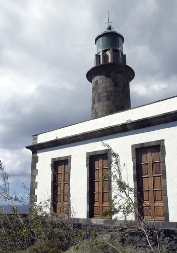
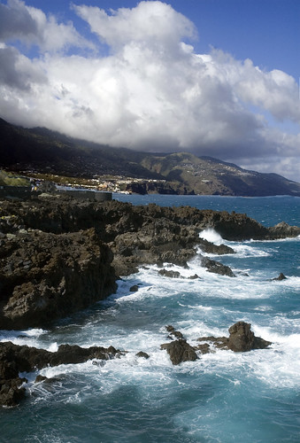
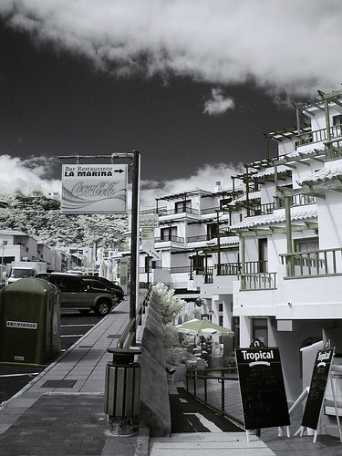
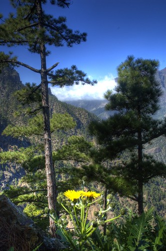
Tazacorte is on the west (and warmer) coast of La Palma.  It was only about a 45 minute drive from the east coast area where we were staying, but very different from Los Cancajos and the terrain of the east coast.  It is partially blocked from the trade winds by a mountain range, so is warmer and sunnier.  This area (the puerto) in Tazacorte is the main port area and was the original area where  Spanish explorers landed.  The deeper port is now replaced by a much shallower beach/swim area and is the main tourism area for the western coast.  There were lots of options for lodging, although more condos and guest houses than big hotels.  Here's a webcam from the Atlantis, one of the hotels.  Outside of this area, was a charming city (the pueblo), and the rest of the land (85%) was cultivated with banana growing.  It was really amazing how every available piece of land had banana trees.  More shots from the Atlantis site, show the terrain and banana trees.  Some of them were in structures with plastic and frames that formed a temporary greenhouse.  If you look at satellite shots on Google Earth of La Palma, you will see large areas of land that appear white.  These are the banana plots.
Both of these shots are HDR with the saturation turned up slightly to really bring out the colors on the beach and of the buildings.

Day 4: Nogales and the Northeast Coast


These two shots were taken along the northeast coast.  The first is at a roadside vista point with a sculpture to honor those making the highway (I think).  There was no notation of who the artist was.  
The second is a view of Nogales Beach.  One of our guidebooks noted that Nogales Beach was a "short and easy" walk from the parking lot.  After driving down quite a highway snaking along the cliff, we arrived at a parking lot that offered a beautiful view and a trailhead.  30 minutes later after climbing down 276 steps and a series of ramps we arrived on the beach.  The view was beautiful and the beach was almost deserted.  The sand, like most of the island was black sand.
Both of these shots are infrared, shot with the Olympus.  As you can see, the day was overcast, so it made photography challenging, but with interesting sky at least.

Sunday, April 27, 2008

Day 5: Tip of the Island - Fuencaliente


First photo, Abandoned Faro, the old lighthouse at the southern tip of the island.  The second photo is of the salt paddies, adjacent to the lighthouses.
The southern tip of La Palma, in contrast to the northern tip is quite dry and almost desert.  In the mid-eighties, there was a sudden volcanic eruption that spilled lava over about 1/3 of the southern part of the island.  Now, the area has been rebuilt and farmers are growing crops, including grapes for wine, out of the shallow dirt on the hillsides.
We traveled down to this area to photograph the lighthouses, but were quite surprised to fine the sea salt "production" in these salt paddies.  Sea water is pumped up from the water below.  The whole area is on steep cliffs.  These shallow pools are carved out of the black lava rock.  When the water evaporates, the salt is "harvested" into piles and more sea water is pumped back in.  Then, two elderly gentlemen in blue jumpsuits and rubber boots collect the salt and take it into a little shack within the area.  There, they bag it.  They advertise that the sell the salt and we bought some (at only a euro for a bottle of it), but the two gentlemen have to stop their work to sell to the tourists.  Quite an incredible find that doesn't appear to be in any of the guidebooks or advertised.
For every 1000 grams of sea water, only 35 g of sea salt is produced.  It's constituent minerals vary by location, but may include calcium, sodium, iodine, and other mineral chlorides.
Both of these shots were taken with a Nikon D70 - no HDR or any special processing.  The light and sky were perfect for photography that day.

Thursday, April 10, 2008

Day 6: Hanging Out in Los Cancajos


Infrared view of Los Cancajos on the bottom and color at the top from a cliffside path looking northward.  Los Cancajos is La Palma's eastside tourist lodging center.  Here's the Trip Advisor guide to lodging.  Most of the eastside hotels, condos, and aparthotels were located in this area.  It's about a five minute drive from the airport.  The area is carved into the hillside, so has steep streets and offers dramatic views of the ocean eastward.  Further north up the shore (and in the distance in the color shot) is Santa Cruz de la Palma, the capital.  Many of the people staying in our hotel walked into Santa Cruz, but we chose to drive.


Monday, March 31, 2008

Day 7: Hiking the Caldera


Forest PathCaldera de Taburiente National Park:
In the middle of the island of La Palma is a national park that is comprised of the caldera left over from a volcano from.  A caldera is a depression left when the volcano "collapses" on itself.  Much of Yellowstone is a caldera.  The area is now completely forested reflecting how long it's been since the volcano erupted (unlike the lower end of the island that has fresh lava exposed everywhere).  
The top picture, A Dandy[lion] View looks southeast into the valley near El Paso  The clouds move in from the east to the west with the trade winds.  This creates dramatic landscapes from up high on the mountain, looking into the valley to see the clouds creeping across.  As the day went on, this view was almost completely obscured.   This shot is HDR. 
The second photo, Forest Path, shows hikers on a path ahead of us.  This trail was labeled as "easy", but that was by European rather than American standards.  It took us 2 hours and wound down into the caldera, along a narrow ridge, and then up a steep cliff by switchbacks at the end when we were already tired.   This shot is infrared, by instead of being with my Olympus 2000 Zoom (see below), is with my Nikon D70.  I was lucky that it was fairly light, so was able to capture the scene with a fairly low shutter speed.   

Sunday, March 2, 2008

Day 8: Adios Espana


For the grand finale of our trip, we finished with a night in Madrid (prior to flying out the next morning).  We stayed at Room-Mate Mario, on Calle Camponmanes (view from the room in the top picture above) in Old Madrid, a few blocks from the Opera and the Palacio Real (Royal Palace).  We found the Room-Mate chain to work out quite well.  They are well located, relatively inexpensive for Madrid at about $150 per night (breakfast included).  The rooms are small, but well appointed and with modern (aka funky) decoration.  The breakfast area was a bit odd with bright green walls and space age transparent plastic chairs.  A bit hard on the eyes before caffeine.
We dined al fresco in Plaza Mayor (second picture above).  It was warm for a winter night (about 60 degrees) which made the Madrid residents flee inside for warmth and only tourists who were escaping the winter cold from home ate outside.   Plaza Mayor was built in 1617 and is now mostly residential the first floor and above and with stores and restaurants on the ground floor.  In the past it has been used for bull fights, public meetings and executions during the Spanish Inquisition.  See some shots from our previous trip when the courtyard was filled with booths selling christmas items.
 
Both of these night shots were taken with the camera hand held (due to previously mentioned tripod issues), using the automatic night-time settings on the Nikon D70.  PS 3 was used with the raw images to clean up some of the noise and adjust the white balance a bit.    

Wednesday, February 13, 2008

Same Building, Different Techniques


Both of these shots are of Trinity Church in Boston.  The first in infrared and the second in HDR.  Both shots done within a few minutes of each other, but with very different look and impact.  I think the infrared gives a timeless sense to the scene with just a hint of the current day by the context of the surrounding buildings.  The HDR version appears magical with the reflection of sky in the windows giving it a semi-transparent look.  The HDR is shot with a wide angle lens, so the buildings beside it appear to be curving inward.  Also note how the clouds and sky look different in the two shots.